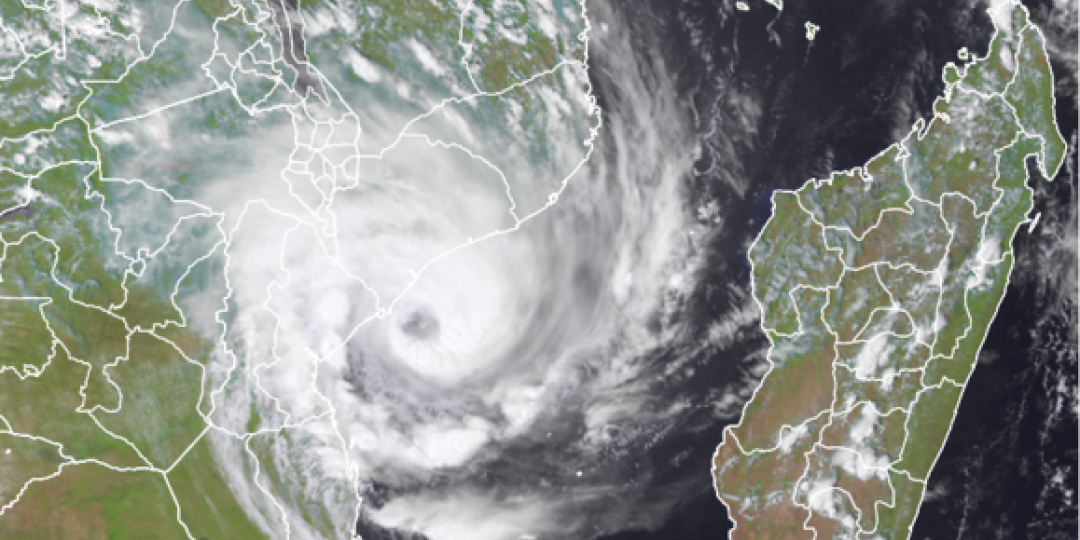
The Indian Ocean cyclone that posed a threat to shipping in the Mozambique Channel when it spiralled back towards the sea after making landfall, was heading back towards the coast where it’s expected to cause heavy downpours.
On Thursday morning it was reported that Mozambique’s National Meteorological Institute (INAM) warned that rain of 200mm and more was expected in the Zambezia Province districts of Pebane and Maganja da Costa.
Early indications of Freddy’s trajectory once it moves inland for the second time – unusual for a cyclone – is that it’s going to spin west-north-west from Zambezia into the province of Sofala, Manica and Tete.
After Freddy made landfall for the first time on February 24, bringing torrential rainfall to the province of Inhambane south of the Port of Beira, it lost intensity before gathering strength once more across the Channel.
It was first recorded on February 6 between Australia and Indonesia, making it the longest cyclone on record.
Current wind speeds of up to 185 kilometres an hour are expected to fall to 75 kilometres when it starts moving across Mozambique again from about Friday evening, according to US Joint Typhoon Warning Centre.
People in the area have been warned of flooding because of rapidly rising rivers.
Although Mozambique’s N6 route from the country’s Machipanda border is just south of the danger zone, transporters on the Beira Corridor are advised about the possibility of rivers like the Pungwe cutting off access to the port.